


CEDAR RAPIDS, Iowa (KCRG) – We are monitoring the possibility of storms, with an isolated severe storm possible.
Your First Alert: More Scattered Storms Ahead, Some Could Be Strong
(KCRG)
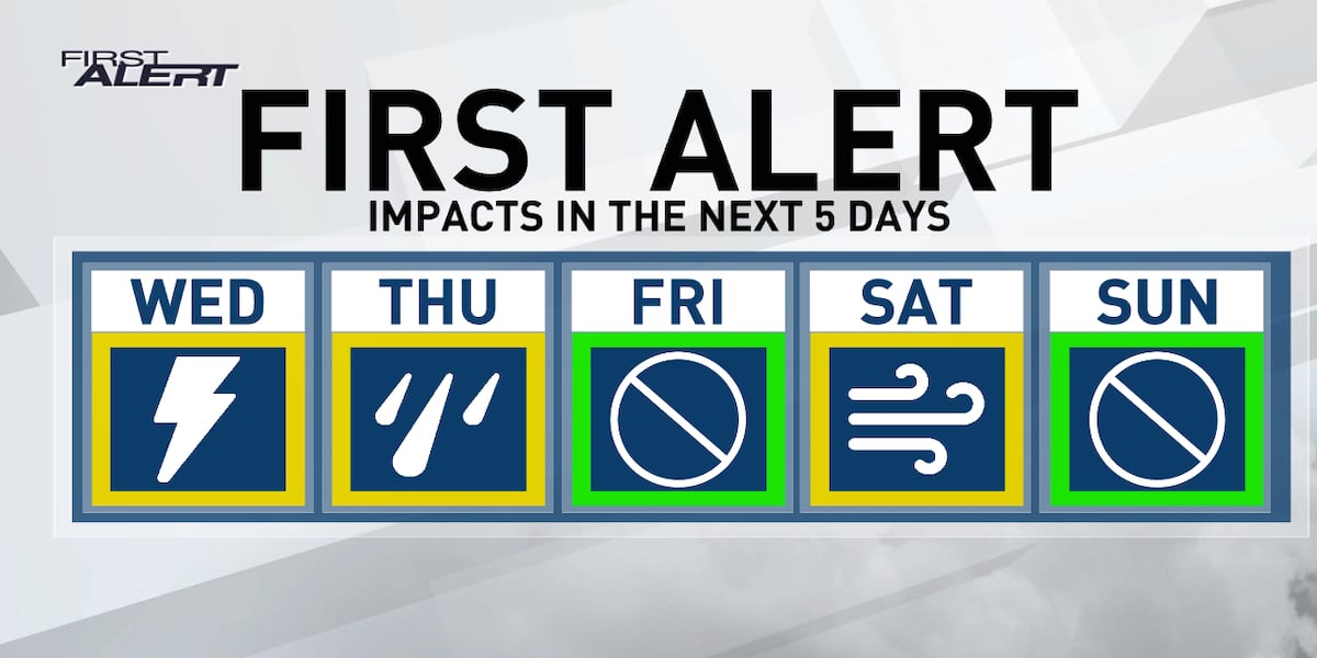
Expect a gradual increase in the number of showers and thunderstorms this evening. The greatest risk for widespread rain will be along and north of US Highway 20 this evening, but almost everyone could see a storm during this active period.
Hail or damaging winds are the main threat in severe storms. A rotating tornado could develop if things go well. Due to this low but still present potential, we encourage you to remain weather aware throughout the day. Get the KCRG First Alert Weather app on your smart device and enable your notifications, while making sure your NOAA weather radio is turned on and ready to receive potential watches or warnings.
Lows tonight will dip into the 50s as cooler air begins to move in. Winds will shift east, then north overnight. Showers and a few embedded storms will continue at times Thursday, moving slowly from our northern areas to the south. A few additional showers could appear in the wake of this first area, which would keep the risk in the afternoon.
Tomorrow’s highs will be limited by more widespread cloud cover, as well as any rain we may see.
Rather calm around Mother’s Day weekend, with a warming trend
The showers end Thursday evening, leaving behind partly clear skies. A light northwest wind will continue to draw in cooler air, with most areas heading into the low 40s for lows. A few places in the north could be in the upper 30s, especially in lower elevation areas like river valleys.
A mix of sun and clouds looks likely on Friday, with temperatures slightly warmer than Thursday. Highs are heading into the lower to upper 60s from north to south, which is near or just a few degrees below normal for this point in the calendar. It is also the first sign of a warm-up that will last for the next few days.
A fast-moving disturbance will move across the Great Lakes region Friday evening, bringing with it the possibility of a few showers. The TV9 viewing area will be in the far southwest of this area, but should be close enough for a few areas to experience brief rain or showers. Any rain would remain fairly light.
Drier weather appears likely for much of Saturday and Sunday, as temperatures continue to climb into the 70s. Mother’s Day itself appears to be quite pleasant, with temperatures above normal and plenty of opportunities to go out if you have plans with mom.
Your First Alert: More Chances of Showers and Thunderstorms Next Week
After a break of a few days in more active weather, the risk of additional precipitation returns on Monday. A frontal boundary will be close to the state at times, providing the focal point for occasional showers and storms to develop.
Chances are low on Monday at this point, with an increasing threat of showers and thunderstorms towards the middle of next week. Things could peak in terms of precipitation potential on Wednesday as an area of low pressure moves through the region.
Temperatures next week are expected to remain warm, with highs in the mid to upper 70s for many.
Copyright 2024 KCRG. All rights reserved.


