


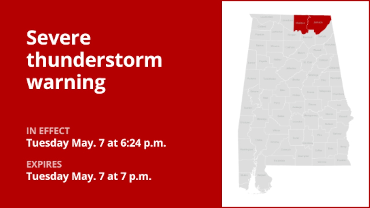
On Tuesday at 6:24 p.m., an updated severe thunderstorm warning was issued by the National Weather Service, valid until 7:00 p.m. for Jackson and Madison counties.
The storms could bring wind gusts of up to 60 mph and walnut-sized (1.5 inches) hail.
“At 6:24 p.m., a severe thunderstorm was located near New Market, 10 miles northeast of Moores Mill, moving northeast at 30 mph,” the weather service said. “People and animals outside will be injured. Expect hail damage to roofs, siding, windows, and vehicles. Expect wind damage to roofs, exterior coverings and trees.”
Locations affected by the warning include Winchester, Hazel Green, Huntland, Tims Ford Lake, New Market, Lincoln, Hytop, Lexie Crossroads, Plevna and Harmony.
According to the weather service, “For your protection, relocate to an interior room on the lowest floor of a building. Prepare immediately for large hail and deadly lightning between clouds and ground. Seek shelter inside a well-constructed structure. Stay away from windows.
Preparing for impending lightning strikes: Expert safety recommendations
Each year, lightning strikes the United States approximately 25 million times, with the majority of these electrifying events occurring during the summer months. Unfortunately, lightning is responsible for the deaths of approximately 20 people each year, as reported by the weather service. The threat of lightning becomes more pronounced as thunderstorms get closer, peaking when the storm is directly overhead and gradually diminishing as it moves further away.
To ensure your safety in the middle of a storm, consider the following recommendations:
1. Lightning protection plan:
- When venturing outside, it’s essential to have a clear plan for shelter in the event of lightning.
- Stay vigilant by monitoring the sky for ominous signs and listening for the telltale sound of thunder. If thunder is audible, it is a clear indication that lightning is nearby.
- Quickly seek shelter in a safe place, preferably indoors.
2. Indoor safety measures:
- Once indoors, avoid using corded telephones, electrical appliances, plumbing fixtures, and stay away from windows and doors.
- These precautions help reduce the risk of electrical surges because lightning can follow conductive paths.
3. Wait for the green light:
- After the last flash of lightning or thunder, wait at least 30 minutes before resuming your outdoor activities.
- Lightning can strike even when a storm appears to have passed, so be careful.
When indoor shelter is not available:
If you find yourself outside without access to indoor shelter during a thunderstorm, follow these steps to maximize your safety:
- Avoid open fields, hilltops or ridge crests, which put you at greater risk of lightning.
- Avoid large, isolated trees and other prominent objects. In forested areas, stay near lower stands of trees.
- If you are in a group, make sure individuals are spaced apart to prevent lightning current from being transmitted between people.
- Camping in open areas during a thunderstorm is strongly discouraged. If you have no alternative, set up camp in a valley, ravine, or other low-lying areas. It is important to note that a tent does not provide any protection against lightning.
- Do not approach bodies of water, wet objects or metal objects. Although water and metal do not attract lightning, they conduct electricity efficiently and can pose significant risks.
In summary, when faced with the threat of lightning, vigilance and preparation are your best allies. By following these guidelines, you can significantly reduce the risk of lightning-related accidents and prioritize your safety.
Rainy Roads Ahead: Essential Safety Tips in Heavy Rain
In case of heavy rain, safety is paramount. Equip yourself with these guidelines from the weather service to navigate wet roads and avoid dangers:
Beware of rapid water flow:
- Avoid parking or walking near culverts or drainage ditches, as fast-moving water during heavy rains can potentially wash you away.
Maintain safe driving distances:
- Respect the two-second rule to maintain a safe distance behind the vehicle in front of you. In heavy rain, allow an extra two seconds of distance to compensate for reduced traction and reduced braking effectiveness.
Reduce speed and drive carefully:
- On wet roads, reducing your speed is crucial. Release the accelerator pedal gradually and avoid sudden braking to avoid skidding.
Choose your path wisely:
- Stick to the middle lanes to minimize the risk of hydroplaning. Exterior pathways are more prone to water accumulation.
Prioritize visibility
- Turn on your headlights and watch out for other vehicles behind you and in blind spots, as they are especially difficult to see through rain-splattered windows.
Be careful of slippery roads:
- The first half hour of rain is when roads are most slippery due to a mixture of rain, grime and oil. Exercise extreme caution during this time.
Keep a safe distance from large vehicles:
- Do not follow large trucks or buses too closely. The projections created by their large tires reduce your vision. Also be careful when passing them; if you must pass, do so quickly and safely.
Pay attention to your windshield wipers:
- Overloaded wiper blades can impair visibility. If rain significantly limits your view, stop and wait for conditions to improve. Seek shelter in rest areas or protected places.
- When stopping at the side of the road is your only option, position your vehicle as far from the road as possible, ideally beyond the guardrails. Keep your headlights on and activate the hazard lights to alert other drivers of your location.
By following these safety measures, you can significantly reduce the risks and ensure your well-being during heavy rain. Stay informed about weather conditions and heed advice from local authorities to make your trip safe and sound.
Advance Local Weather Alerts is a service provided by United Robots, which uses machine learning to compile the latest data from the National Weather Service.


